Long Range 3D Laser Scanning
3D Engineering Solutions provides long-range scanning technology for 3D data collection in aerospace, nuclear, automotive, power, architectural, civil engineering, construction and industrial markets.
These tools complement our other advanced inspection tools, CAD modeling and reverse engineering capabilities for an integrated approach that meets the needs of Building Information Modeling (BIM modeling), facility mapping, wind energy blade/turbine manufacturing, MSR replacement and much more.
Want to learn more about our long-range laser scanner solutions? Contact us today
Mounted Long-Range Laser Scanning Equipment
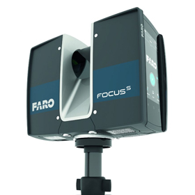
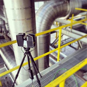
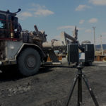
This technology involves using a tripod mounted long-range laser scanning hardware to capture large indoor or outdoor environments. Our terrestrial laser scanning equipment can be mounted in extreme locations with ease. The laser scanners capture a spherical area that extends up to 350m radially.
Our systems employ a phase-based approach to capturing data versus the traditional time of flight method. This means that the data we collect for you is the most accurate available in long-range laser scanning. Our systems provide angular accuracy in the millimeter range while traditional systems capture data to the centimeter.
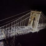
The data is captured as a point cloud in grayscale or color that represents a reflectance value map from the surfaces that are hit by the terrestrial laser. This allows incredible detail to be seen in the scan. When light is available, digital color information is mapped to each point in the point cloud.
This colorized scene allows an easier interpretation of the data for post-processing and analysis. These long-range 3D laser scanners scan at up to 1 million points per second and generate a dense cloud of points for a more full representation. Each individual scan is aligned to all others to provide complete mapping of the site.
This alignment of the data occurs by using measurement targets or/and the natural geometry of the scene being captured. These serve as alignment points for the overall dataset obtained by long-range scanners.
Each scan includes overlapping regions with adjacent scans to help ensure correct alignment. If control (survey data) is provided, then those points can be added to the point cloud data to align more properly to the world and local coordinate systems.
Once the point cloud is aligned, there are several things that can be done with the data.
CAD Models Already Exist
If CAD models already exist for the structure or architecture being scanned, then the point cloud can be overlaid to determine the as-built condition of a structure. This can be useful for understanding the impact of future additions or modifications.
Create a CAD Model
The point cloud data can also be used to create a CAD model that can be used for duplication or addition to existing structures. Modeling of the point cloud data into CAD is accomplished through Revit or one of our industrial CAD packages (SolidWorks, NX, Creo). Our internal degreed engineers use the point cloud as the starting point to create geometry that is imported or natively brought into one of these CAD packages.
Note that we have methods that allow us to idealize objects (parametric modeling) in the scene or to keep them in their natural non-perfect or deformed shapes (NURB modeling). We have developed methodologies to allow for modeling non-perfect conditions when needed. Whether you require a high level of detail or a lower level of detail modeling of your site, we can help.
Compare Scans
You can also compare a point cloud to a point cloud to see effects over long periods of time. For example if you have a structure that is slowly moving or deforming, scans taken at different seasons or over a period of years will give you analysis information on viability or stability. These multiple point clouds are overlaid and then a color map can be given showing the high and low points of deviation or movement.
Exact Location
With 3D laser scanning, you no longer have to rely on a simple 1D tape measure or Laser Distance Meter field measurements that do not relate all of the measurements together in 3D space. The 3D laser scanner captures everything in its exact location every time. Long-range laser scanning can be used to capture data from remote locations for future use in upgrades and auxiliary measurements. You then have a virtual geometrical database of your remote sites that can be called upon at will.
Moving Large Structures
3D scans can be used for clash detection when moving large structures inside or within buildings. Are you moving manufacturing equipment into your existing buildings? Do you want to be sure that transportation to their final location goes without issue? We can scan the existing areas and overlay CAD models of the new structures you want to put in place and then communicate if and to what extent there are inference or clearance issues.
Mapping
The mapping of underground caves and tunnels with this 3D technology is a quick and efficient process. We can deploy our teams to these low light level areas and fully capture all line of sight areas at all levels throughout the structure.
Overhauling large pipping networks is also possible through this technology. With time, materials transported through piping networks erode then and replacement is required. A 3D map of the existing network allows for easy quotation and eventual replacement.
Buildings, ships, and bridges are easily captured and digitized. You can even capture this data over time for comparison. This allows you to assess changes in these structures over time which can serve for understanding when replacement or repair is needed.
Damaged structures can also be captured for use in litigation or failure analysis. This tripod mounted long-range equipment is ideally suited for the remote data capture of hazardous areas where it is not safe to allow people to enter. Once the data is captured, clean up can start and you are assured that the exact conditions are digitally preserved.
Archeological applications are numerous. Long-range data capture is excellent for preservation and the academic study of ‘one of a kind’ ancient treasures.
All Data Belongs 100% To Our Customers
All data captured and created by 3D Engineering Solutions belongs 100% to our customers. You can also request a copy of the raw point cloud data for your own post-processing or modeling needs. We also keep, with permission, a copy of that data indefinitely in case future needs from you require it.
Our 3D scanning services are available 24/7. Please contact us with your long-range scanning needs today. Our large friendly degreed engineering staff is ready to serve you.
FAQs
-
What is long-range scanning?
- Long-range scanning is the process of making measurements at a distance using long-range laser scanning equipment with features like HDR imaging to capture large indoor or outdoor environments. This data is captured as measurable 3 dimensional data.
-
How does long-range laser scanning work?
- Long-range laser scanners work by using a powerful (but eye safe) terrestrial laser scanner to capture point cloud data in a fixed location, while other laser scanning equipment must be handheld or vehicle-mounted to gather data. The data is captured in a spherical fashion based around the scanner.
-
How accurate are laser scanners?
- Laser scanner accuracy varies depending on the specific equipment used. Traditional long range laser scanners provide measurements to the centimeter, while cutting-edge long range scanners used by 3D Engineering Solutions are accurate to the millimeter.

